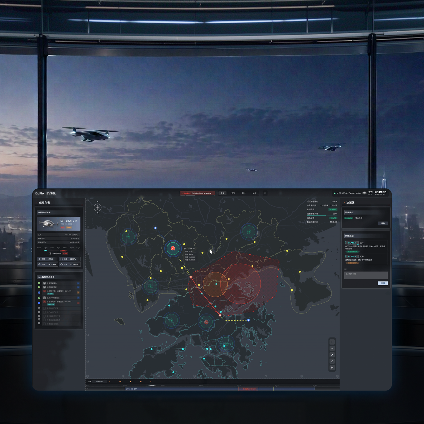
CoFly low-altitude traffic coordination platform and flight scene

System / UX Design | Industry–University Project | 2026.05—07

CoFly Low-altitude Traffic Coordination Platform

Project overview

A collaborative platform for future low-altitude traffic operations in the Greater Bay Area, with AI handling routine dispatch and coordinators retaining key decisions.

My work

Researched airspace management and route safety, structured the information architecture and core flows, and co-created the high-fidelity interface and interactive prototype.

Project outcomes

Human-AI mechanismAI-assisted rapid decisions
High-fidelity UICoordinator workflow system
Functional prototypeDynamic weather routes
Scroll to explore

From aircraft development to city-scale operations

An eVTOL is an electric aircraft capable of vertical take-off and landing.

UAM—Urban Air Mobility—uses eVTOL and related aircraft for commuting, connections, and logistics within cities and metropolitan regions.

BackgroundProject context

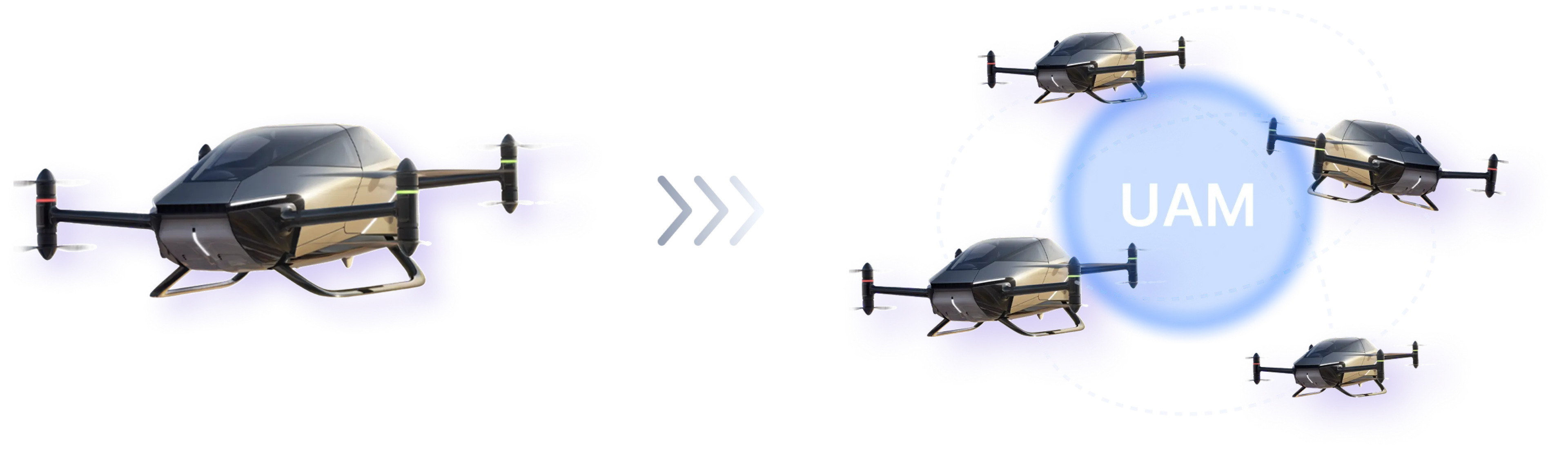
A single eVTOL developing into a city-scale UAM network
As more flight missions enter limited low-altitude airspace,UAM systems must coordinate flight status, weather changes, airspace rules, and multiple stakeholders.
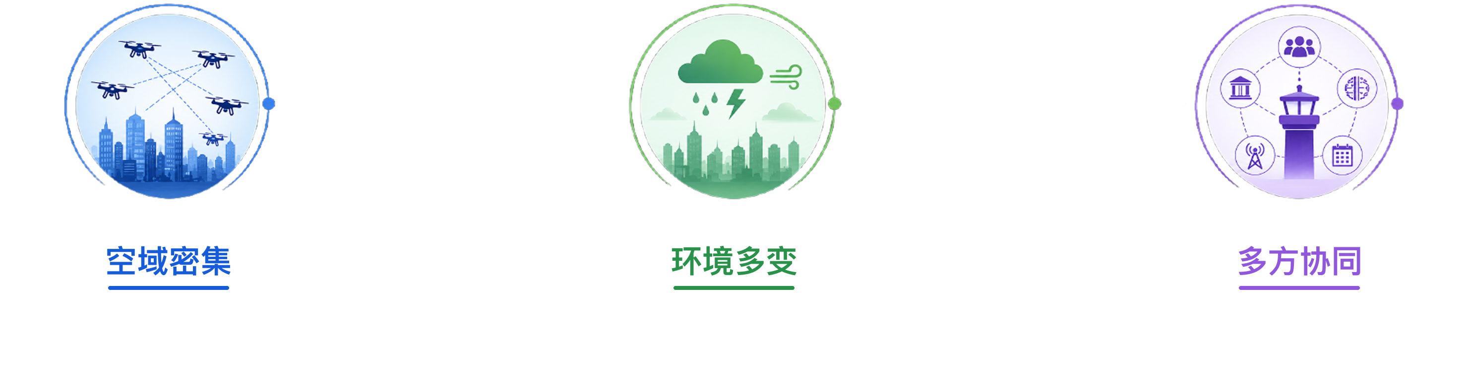
Three urban air mobility challenges: dense airspace, changing environments, and multi-party coordination.

The operational challenge is shifting

The central question is moving from “how to fly” to “how to manage flight safely and efficiently under dynamic conditions.”

These changes show that low-altitude traffic requires a new approach to management.

Because “how to manage” is still too broad, we narrowed it through the regional context, coordinator tasks, and gaps in existing frameworks.

Problem Definition问题定义

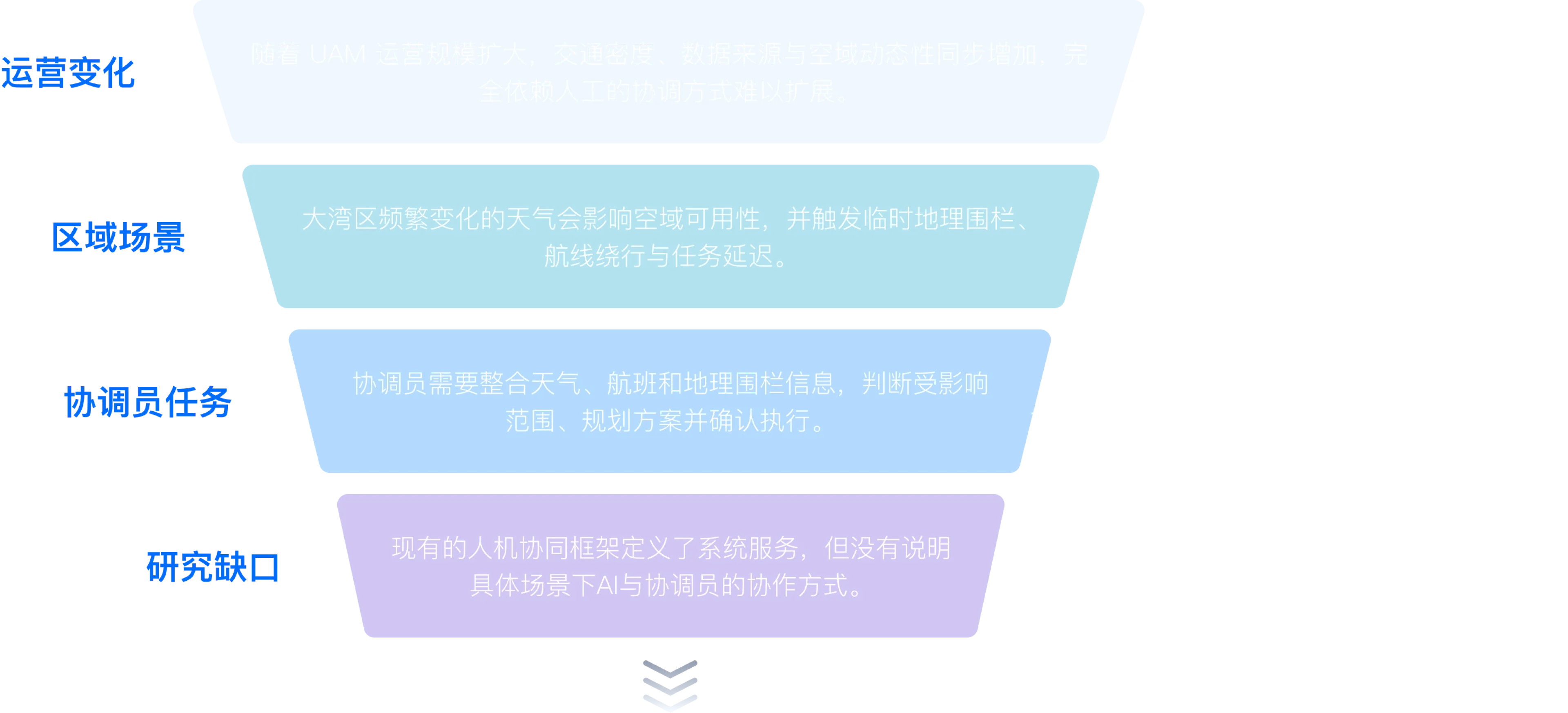
The problem definition narrows through four layers: operational shift, regional context, coordinator tasks, and research gap.

Operational shift

As UAM scales, traffic density, data sources, and airspace dynamics all increase, making fully manual coordination difficult to scale.
Enable Human-AI coordination

Regional context

Frequent weather changes in the Greater Bay Area affect airspace availability and trigger temporary geofences, rerouting, and delays.
Respond dynamically to weather

Coordinator tasks

Coordinators must combine weather, flight, and geofence data to assess impact, plan responses, and confirm execution.
Support the full decision loop

Research gap

Existing Human-AI frameworks define system services but do not explain how AI and coordinators should work together in specific scenarios.
Clarify Human-AI responsibilities
How might AI help coordinators respond efficiently to weather-driven airspace changes while preserving their final control over complex, high-risk decisions?

From system functions to the coordinator’s judgement path

After defining the problem, we reviewed urban air mobility systems, task-processing models, and Human-AI coordination research to structure the coordinator’s cognitive path into four stages.

DevelopmentFramework

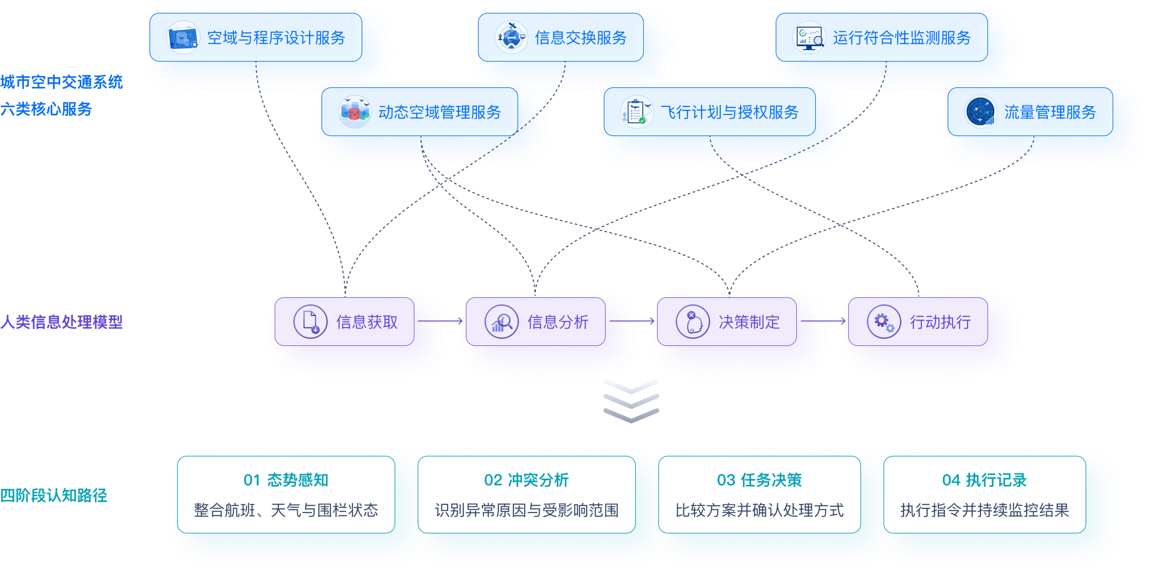
Framework mapping six urban air mobility services to a four-stage human information-processing model and a coordinator cognitive path.

Six core UAM system services

Airspace and procedure design

Information exchange

Operational compliance monitoring

Dynamic airspace management

Flight planning and authorization

Traffic flow management

Human information-processing model

Information acquisition

Information analysis

Decision making

Action execution

Four-stage cognitive path

01 Situational awareness

Combine flight, weather, and geofence status

02 Conflict analysis

Identify causes and affected scope

03 Task decision

Compare options and confirm the response

04 Execution record

Issue instructions and monitor outcomes

Use automation for efficiency while preserving human judgement

The four-stage framework established the working sequence. We then translated it into three actionable design strategies.

Design StrategyDesign strategy

01

Dynamic geofencing

To address
Rapid weather changes make fixed geofences and blanket airspace closures too slow and imprecise for risk response.
Design approach
Update geofence status from weather risk and proactively identify affected airspace and flights.

Expected value

  • Finer airspace control
  • Earlier risk identification
02

Cognitive-stage interaction

To address
Function-led interfaces scatter information and force coordinators to integrate it manually across modules.
Design approach
Organize information and actions around see, understand, decide, and track to keep judgement continuous.

Expected value

  • Shorter decision path
  • Less cognitive switching
03

Human-AI roles in exception flows

To address
Alert-only systems leave complex conflict resolution entirely to human operators.
Design approach
AI generates options, the coordinator confirms or adjusts them, and the system executes while reporting outcomes.

Expected value

  • Faster response
  • Final authority stays human

AI does not replace the coordinator. It handles frequent information processing and option generation so people can focus on complex judgement.

Clarifying core Human-AI interactions in the dispatch workflow

After defining the strategies, we assigned Human-AI responsibilities in the dispatch workflow: the system identifies the conflict type, then either handles it automatically or requests human intervention.

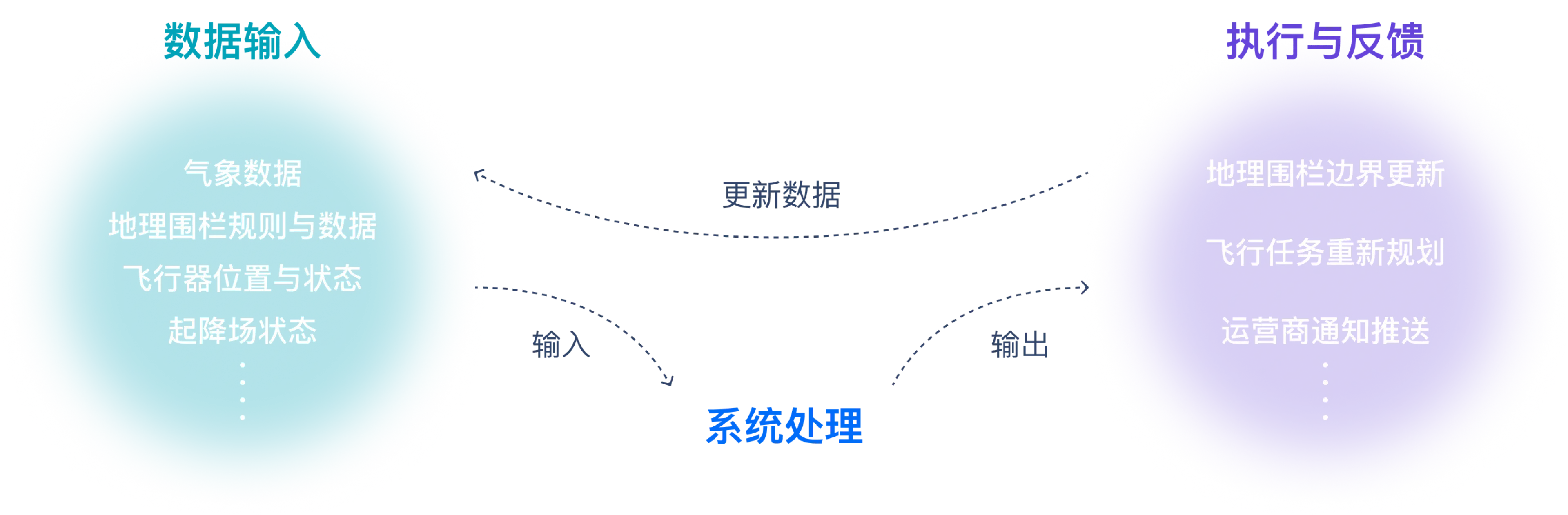
At the system level, the loop has three parts: data input, system processing, and execution with feedback.

Core interactionHuman-AI Workflow

The system loop connects data input, system processing, and execution with feedback.

Data input

Weather data

Geofence rules and data

Aircraft position and status

Vertiport status

System processing

Execution and feedback

Geofence boundary updates

Flight-task replanning

Operator notifications

CoFly Human-AI dispatch platform

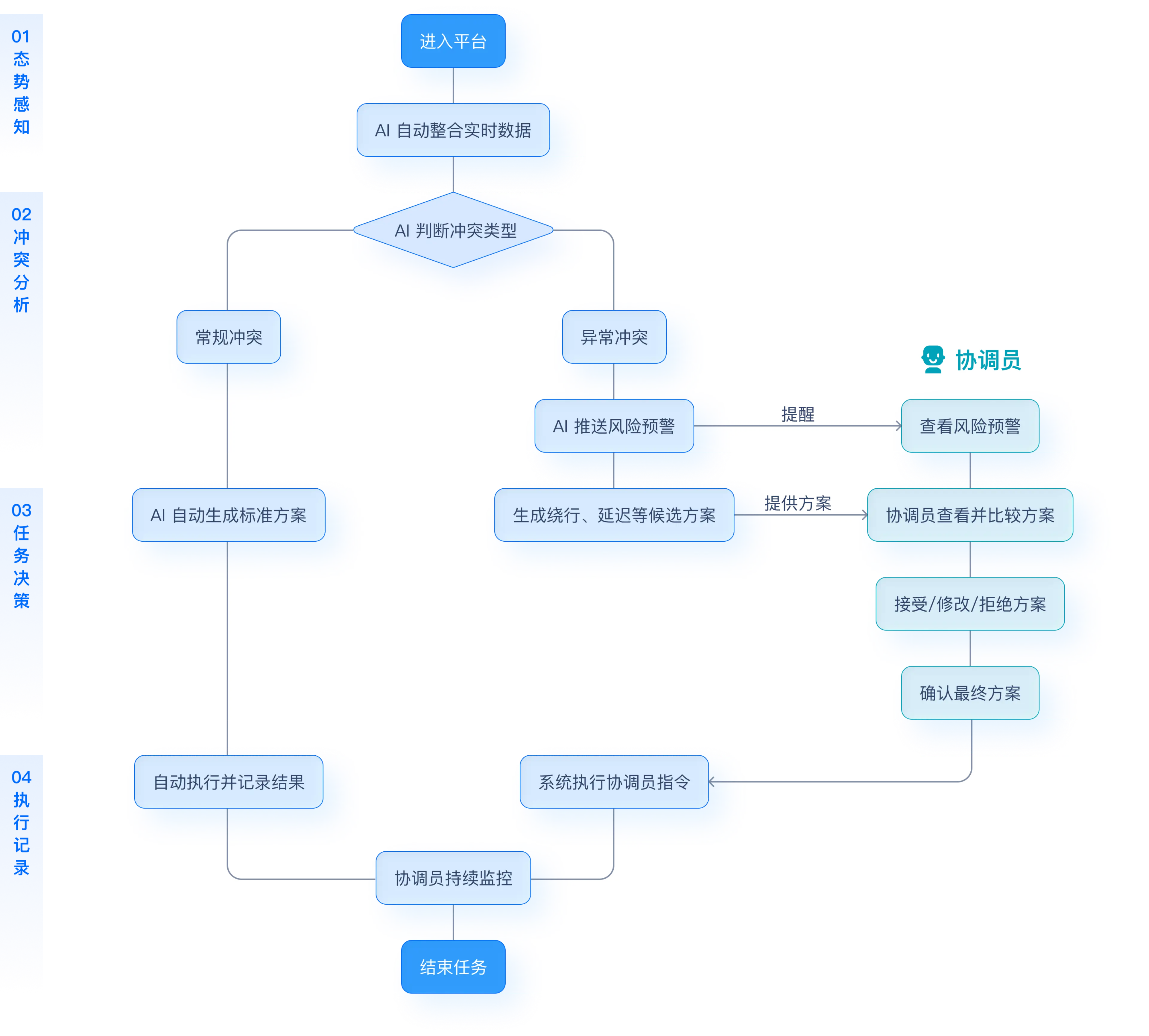
CoFly Human-AI workflow for routine and exceptional conflicts across four cognitive stages.
01

Situational awareness

Enter platform

AI integrates real-time data

02

Conflict analysis

AI identifies the conflict type

Routine flow

Routine conflict

Exception flow

Exceptional conflict

AI pushes a risk alert

Coordinator intervention

Review risk alert

03

Task decision

Routine flow

AI generates a standard response

Exception flow

Generate rerouting and delay options

Coordinator intervention

Compare options

Accept / edit / reject

Confirm final option

04

Execution record

Routine flow

Execute automatically and record results

Exception flow

System executes coordinator instruction

Shared close-out

Coordinator continues monitoring

End task

Automation changes with risk and uncertainty:the more standard the scenario, the more AI handles; the higher the risk, the deeper the coordinator intervenes.

Let the interface follow the coordinator’s judgement sequence

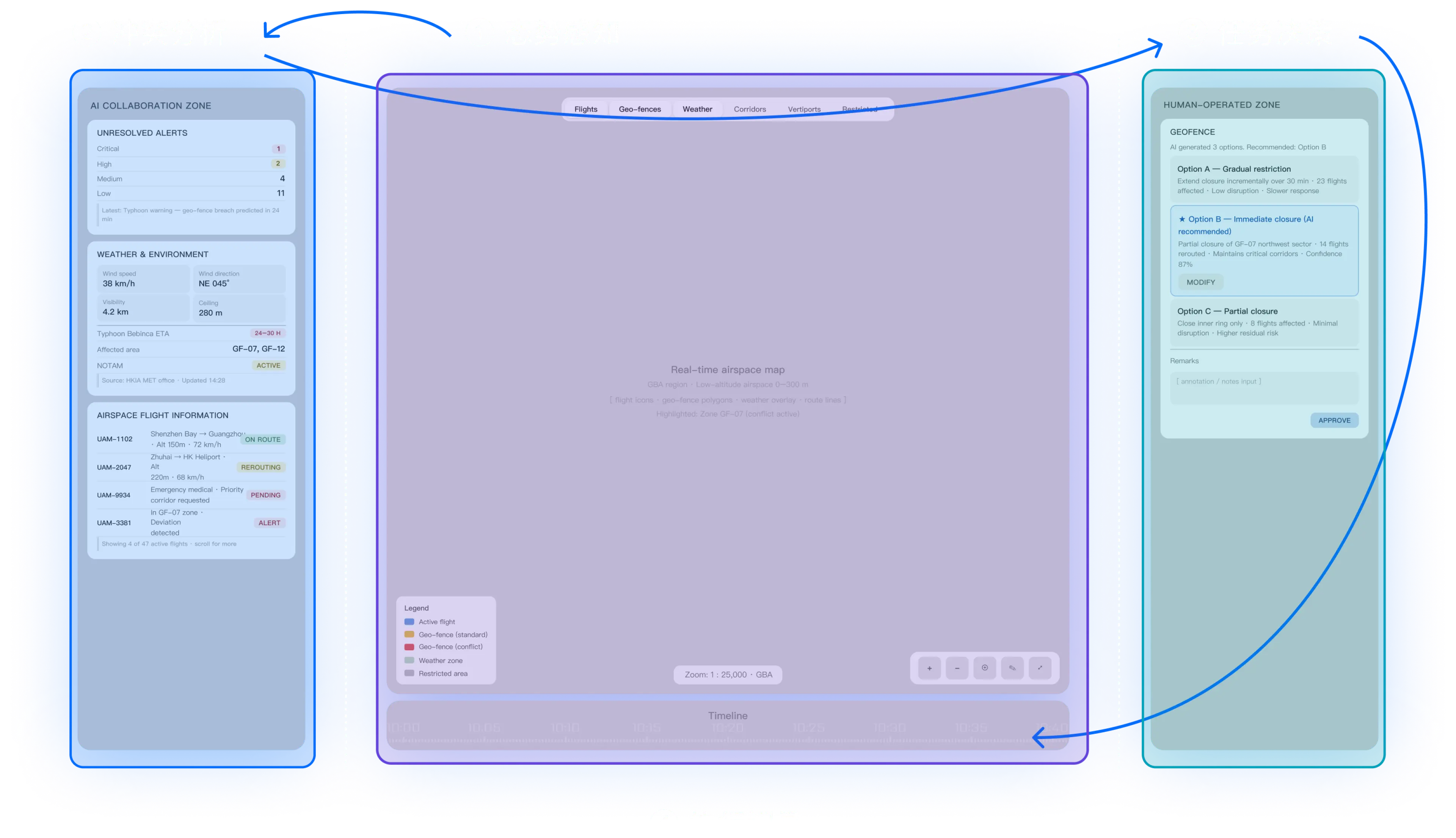
We mapped the path from seeing risk and understanding conflict to decision-making and execution tracking into the interface layout.

Interface Layout页面布局

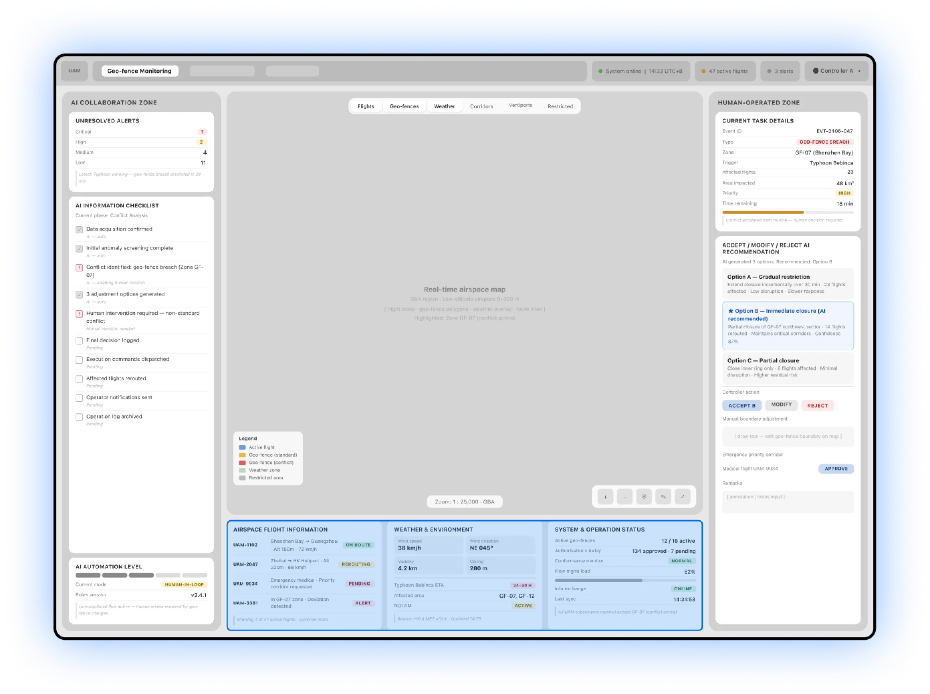
CoFly low-fidelity dispatch interface with an AI collaboration zone, central real-time airspace map, human decision zone, and execution timeline.

Layout iteration

In the first low-fidelity layout, flight and weather information sat below the map. Coordinators had to switch their gaze and combine information manually, weakening the map as the primary situational-awareness view.

We therefore reorganized the information hierarchy:

From function-based placement to decision-stage organization

Keep the central map focused on real-time airspace awareness

Concentrate alerts, weather, and affected flights in the AI collaboration zone

Place options, edits, and confirmations in the human decision zone

Track execution through the timeline and status records

Final layout

CoFly low-fidelity interface annotated with situational awareness, conflict analysis, task decisions, and execution records, linked in judgement order.
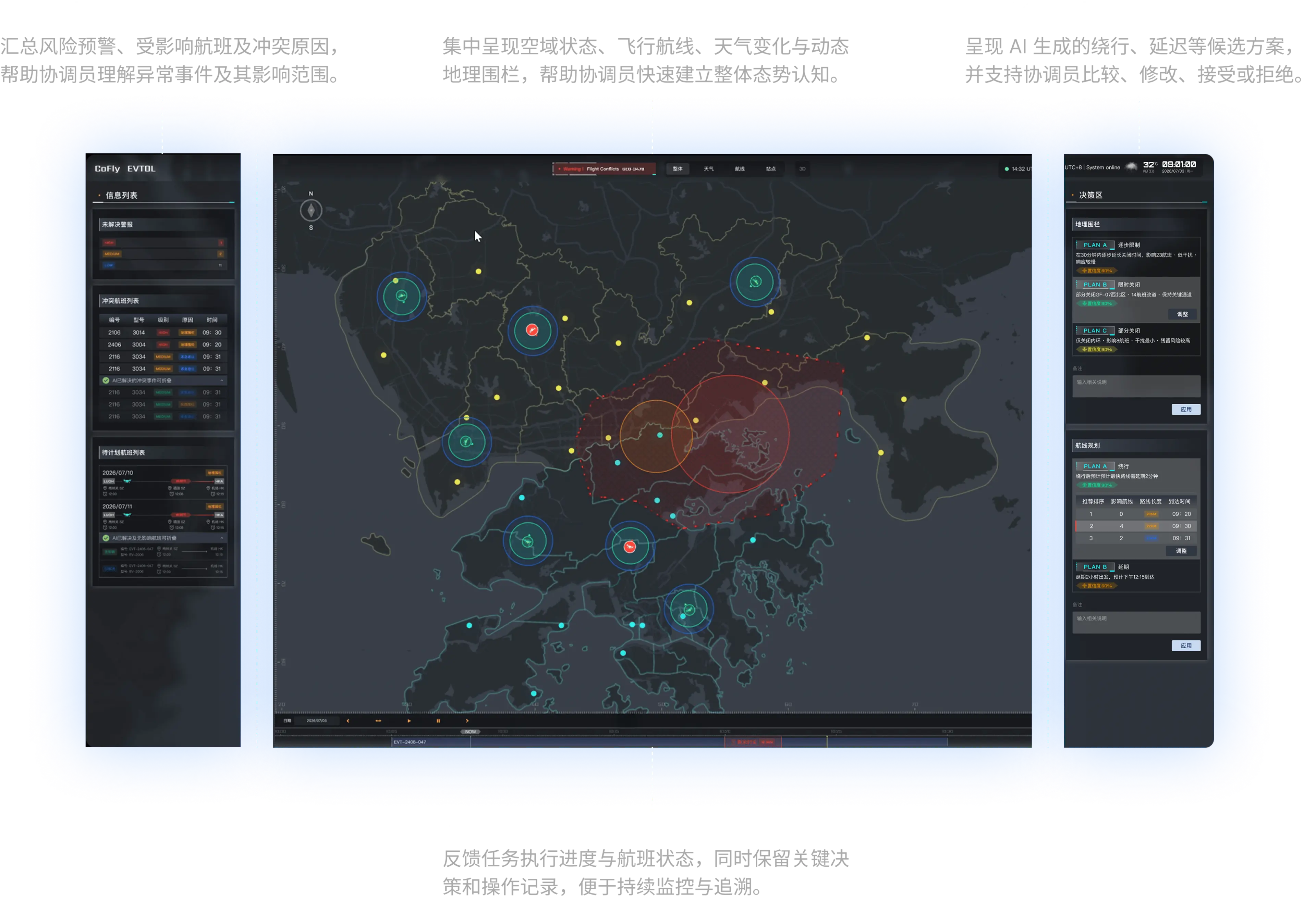
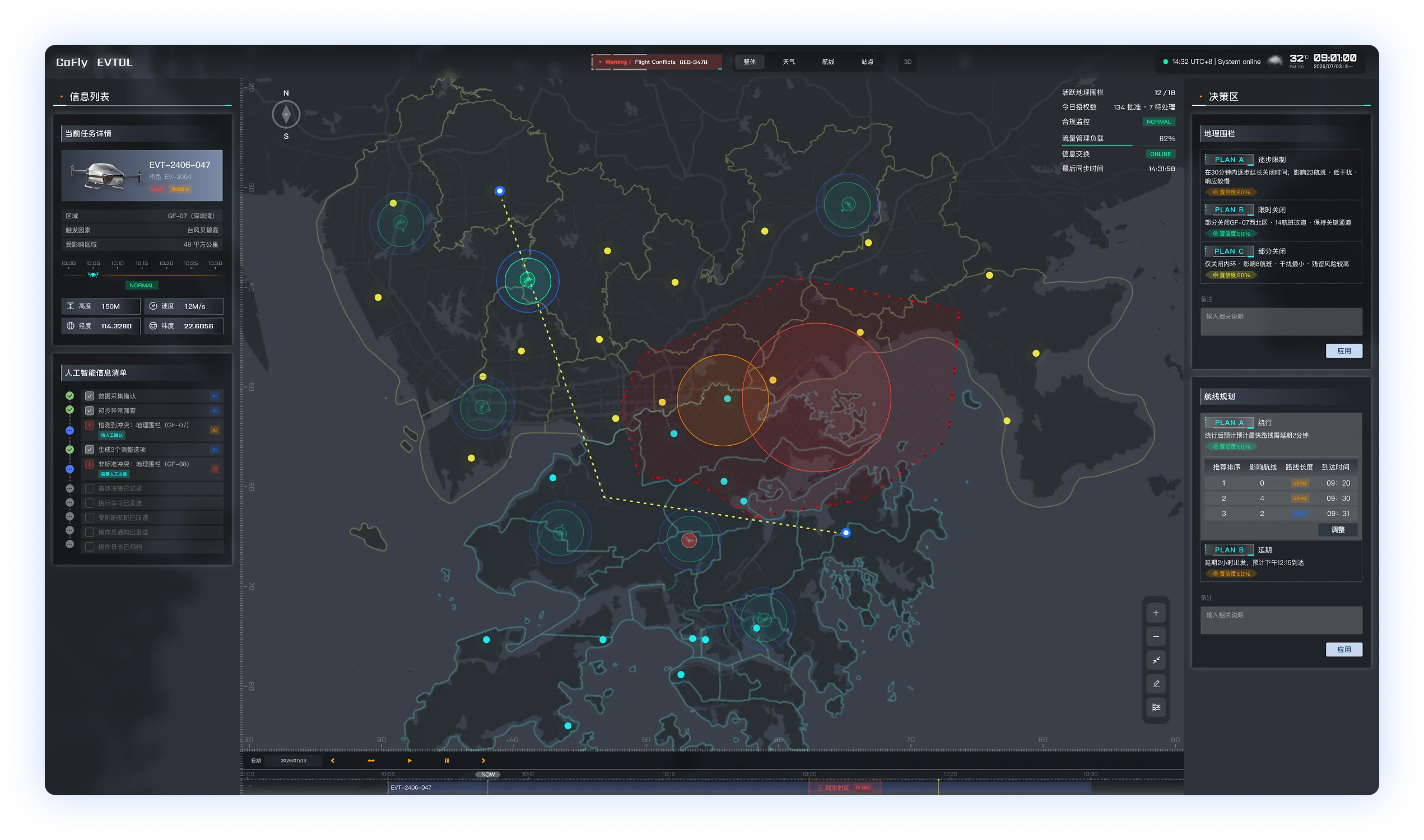
CoFly high-fidelity dispatch platform with AI risk alerts on the left, a Greater Bay Area airspace map in the center, decision options on the right, and execution tracking below.

Key Scenario

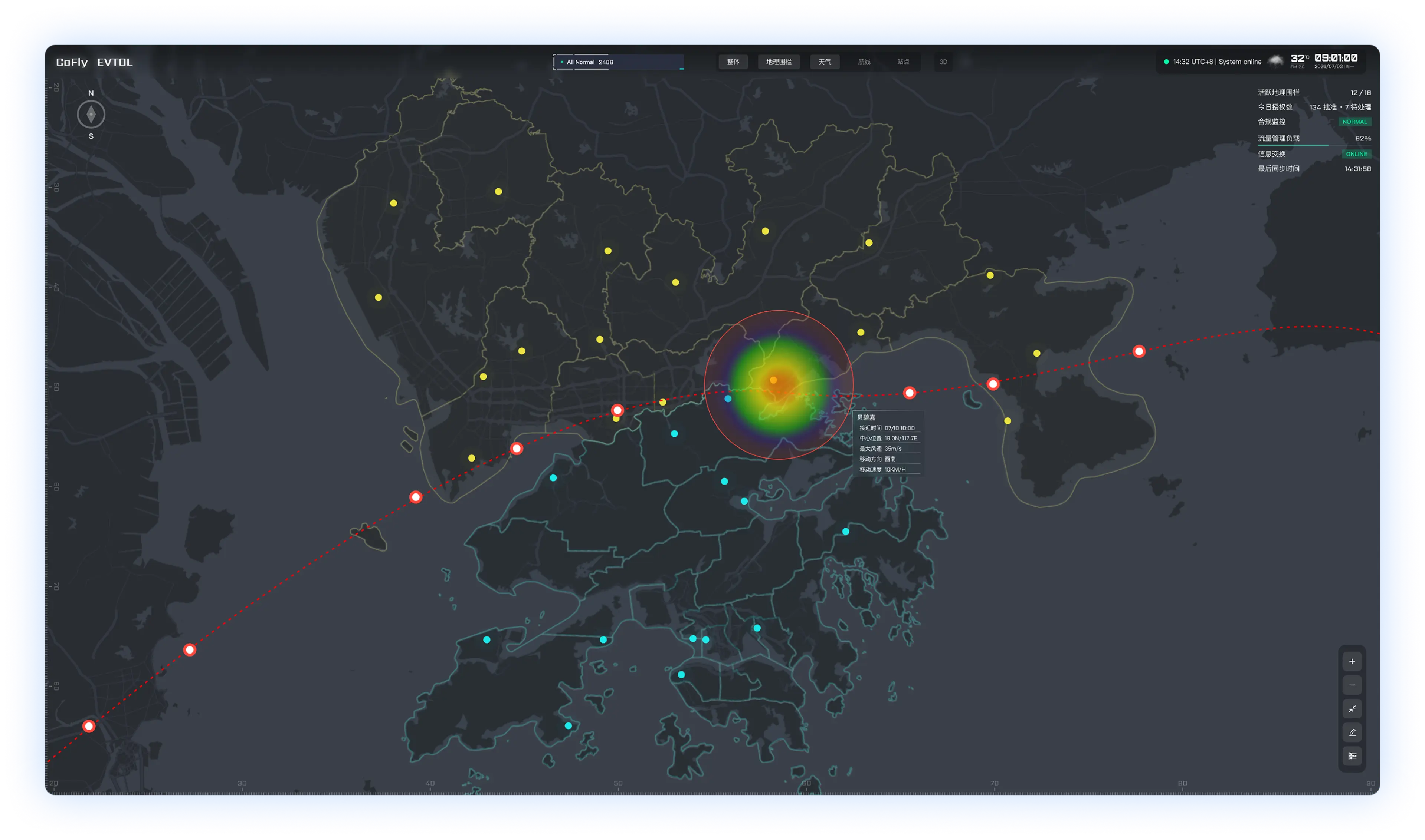
Weather map showing the typhoon’s path and affected area.

Weather enters the system

External weather data defines a new affected area. The system displays its location, extent, and duration.

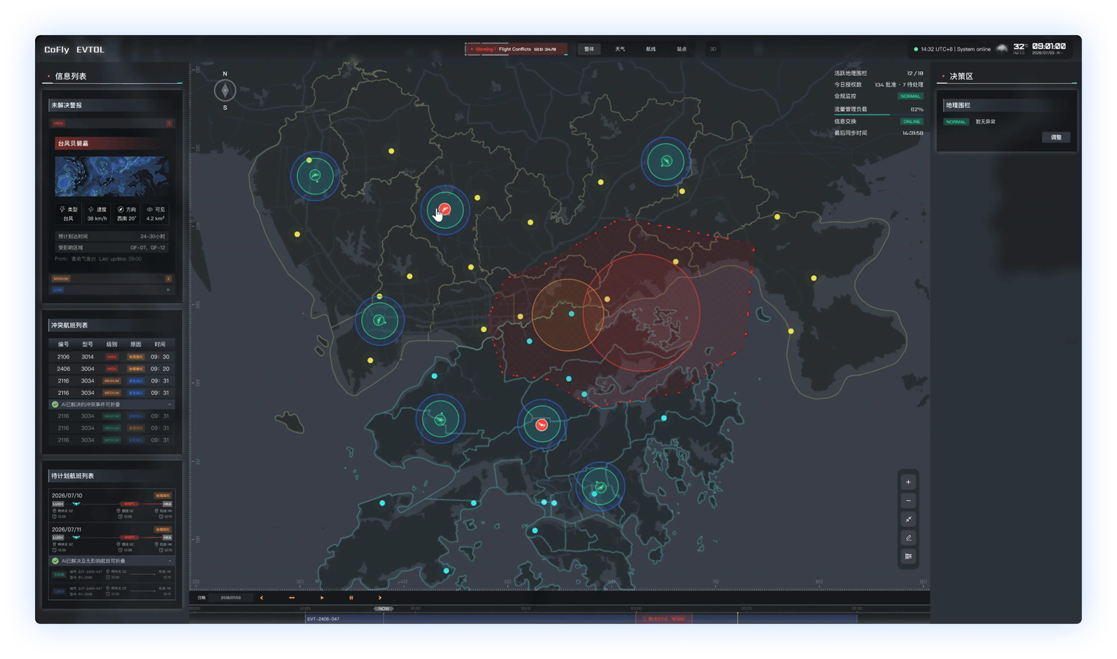
Risk interface showing affected airspace, alerts, and flights in conflict.

Identify risks

AI generates a geofence for confirmation and identifies affected flights, risk levels, and conflict times.

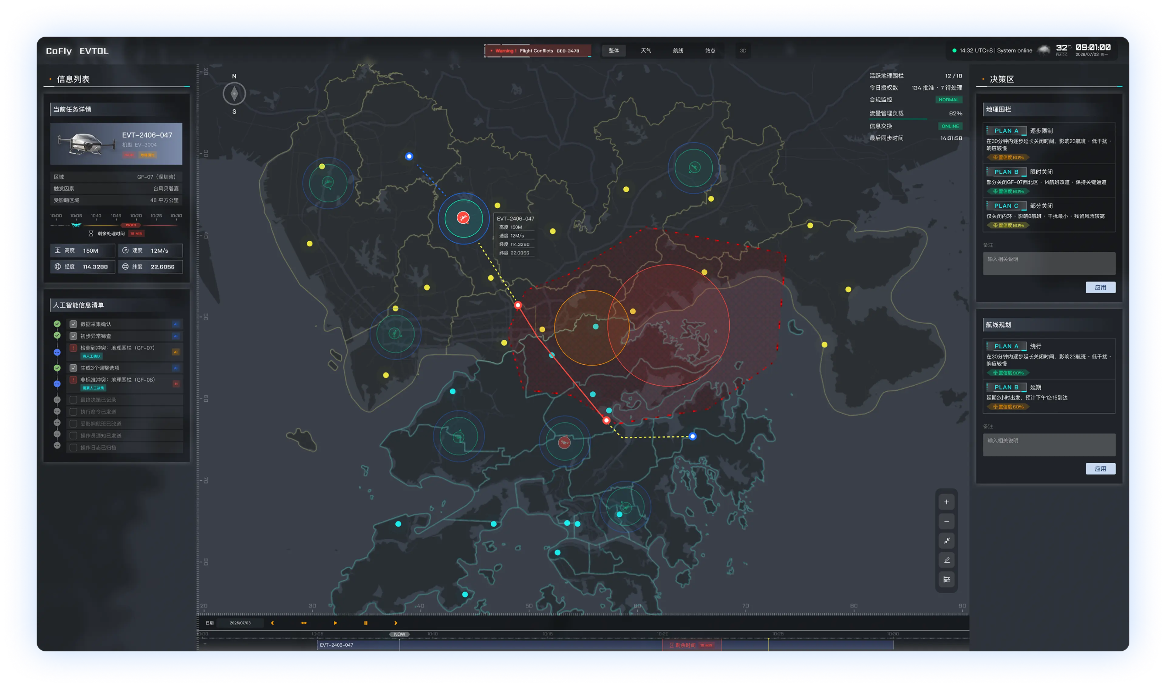
Options interface showing the current task and suggested geofence and route adjustments.

Generate options

AI suggests rerouting or delays and shows their effects on flight distance, timing, and the safety area.

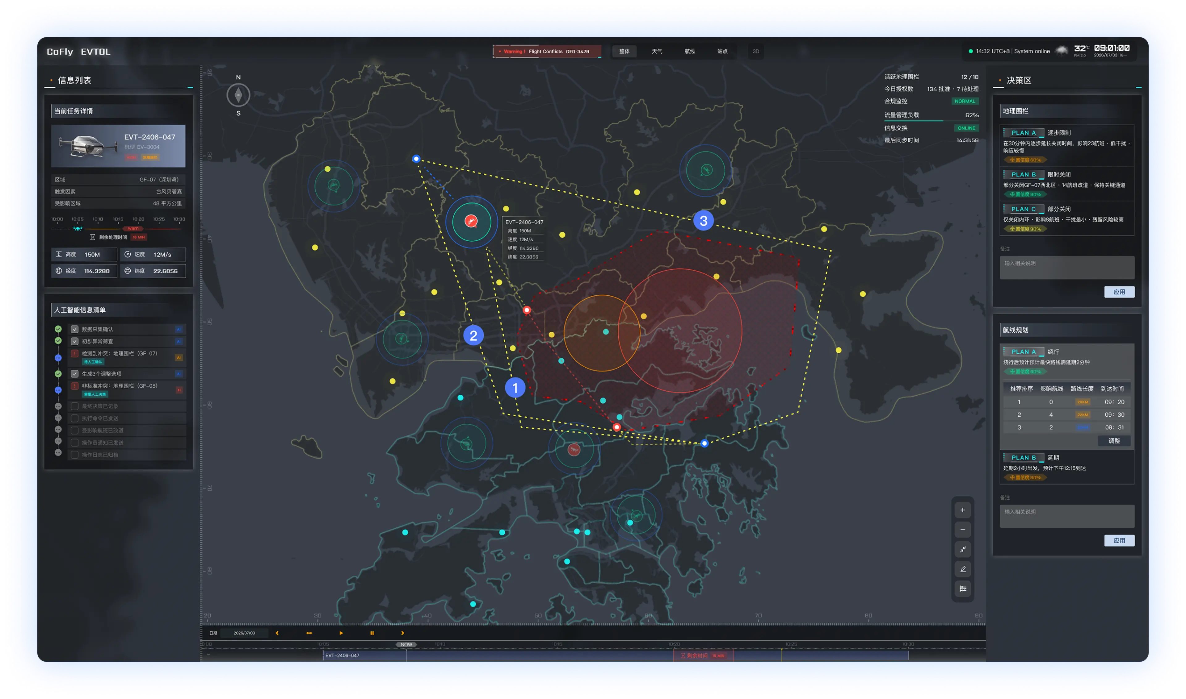
Human decision interface comparing three candidate routes with adjustment controls on the right.

Human judgement

The coordinator compares options and can accept a suggestion, change the delay, redraw a route, or modify the geofence boundary.

Execution interface showing the selected new route and an updated normal flight status.

Confirm execution

After the coordinator confirms, the system updates geofences and flight tasks and displays the new routes and statuses on the map.

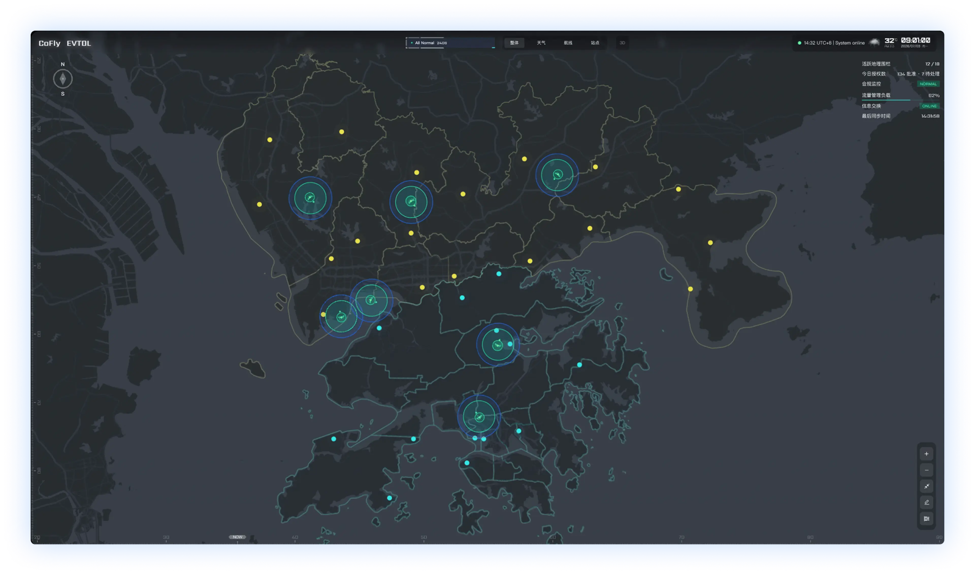
Monitoring map showing active flights and the overall airspace status.

Ongoing monitoring

The system keeps checking weather conditions. If they change again, approved flights are flagged for the coordinator to adjust a second time.

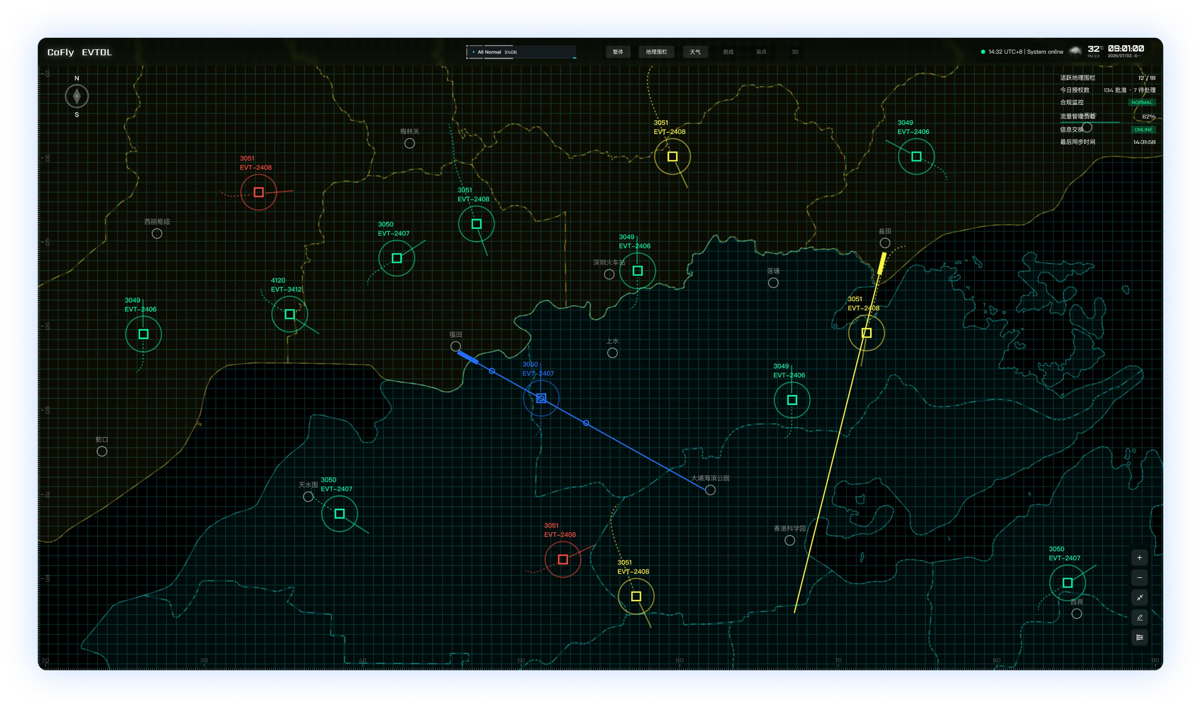
Flight-track view showing flight identifiers, positions, headings, and routes on a grid map.

Review flight tracks

Switch to the flight-track view to inspect flight positions, headings, and route relationships, helping the coordinator review the updated operating situation.

Prototype

Bring human–AI coordination to life in dynamic scenarios

The team built an interactive functional prototype that simulates weather changes and route conflicts, connecting risk identification, option comparison, human confirmation, and execution feedback to check the core dispatch workflow.

Watch the prototype demo

About 2 minutes · English subtitles

  1. Weather changes
  2. Risk identification
  3. Suggested options
  4. Human confirmation
  5. Execution feedback
Open video separately